Projects
Get your next project done with us!

Dome Light
Dome Light is one of the works of the Elins Research Club, especially the robotics division. This dome light project is one of the projects that prioritizes image processing methods by doing 3D scanning of certain objects.

K3 Project
The K3 or Occupational Safety and Health project is a collaboration between the Elins Research Club and the Vocational School of Universitas Gadjah Mada. This project has a main focus on observing work safety in rooms that have high cabinets in hospitals. This tool is expected to be a safety detector for people who will take something in these high cabinets. The technology used in this project is to use computer vision equipped with a camera.
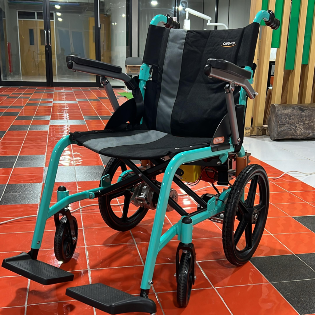
Autonomous Wheel Chair
This autonomous wheelchair is equipped with LiDAR and computer vision technology to detect the environment and navigate independently. The system allows the wheelchair to follow the caregiver automatically, eliminating the need for manual pushing.
PLN 2024
This robot functions to monitor electrical substations that still use analog instruments, replacing the human workers who previously performed this task. The robot is designed to reduce accidents, improve safety, and increase productivity.
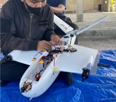
Karhutla
Karhutla is a UAV platform equipped with an E-Nose system. The E-Nose system is a detector capable of identifying forest fires. It consists of four gas sensors: MQ-9 (carbon monoxide), MQ135 (ammonia gas), TGS 2600 (hydrogen gas), and TGS 2602 (ammonia gas). Karhutla is also integrated with deep learning technology to classify whether a forest fire has occurred. Additionally, Karhutla includes a dashboard to display data from the E-Nose and the location of the fire. The dashboard features include location, dashboard view, and status.

E-Drones
E-Drone is a UAV vehicle equipped with a Flight Controller made by Elins Research Club, especially the Aeromodeling division. Flight Controller or FC made by Elins Research Club is known as FC Avionics, which by developing its own FC will save costs rather than buying FC directly, this is the basis for making FC Avionics.
3D Scanner Drone
This project is part of our Student Creativity Program in Research (PKM-DR), where we develop drone-based 3D scanning technology. Our device can scan objects in three dimensions with high accuracy, making it ideal for applications like digital archaeology, building structure mapping, and reconstructing real-world objects into digital models. By combining LIDAR sensors, depth cameras, and image processing software, we designed the drone to fly stably while capturing detailed scans from multiple angles.
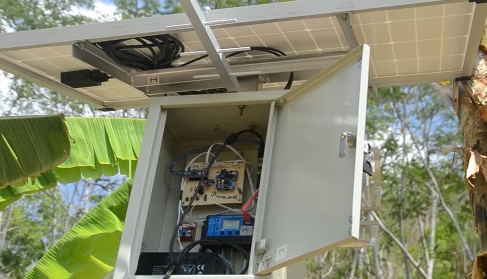
G-Connect
G-connect is an Early Warning System or EWS that functions in predicting floods and landslides. The making of this G-connect is directly under the auspices of the Computer and Network Systems Lab of the Department of Computer Science and Electronics, FMIPA UGM. As for some sensors and devices that are included in this G-connect are tilt sensors, GPS, temperature & humidity sensors, water level sensors, wind speed sensors, soil moisture sensors, and buzzers as indicators.
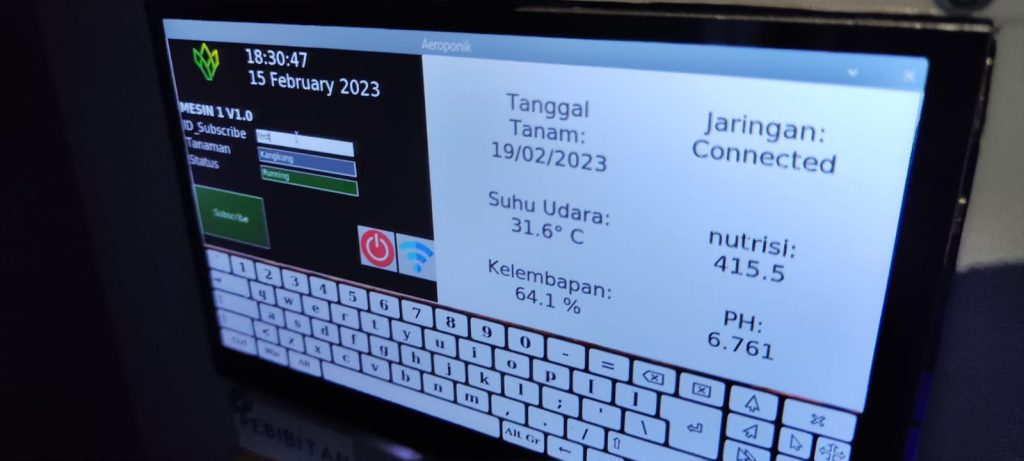
Aeroponics
Aeroponics is an innovation by the Elins Research Club, specifically from the Linux and Networking division, focusing on the agricultural sector. Aeroponics is a device capable of controlling and monitoring pumps and nutrient delivery for plants. It also features a dashboard to display real-time variables such as temperature, pH, nutrient levels, and humidity.
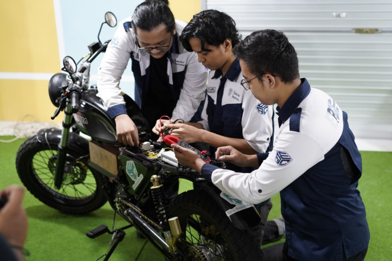
Gasbadra Electric Motor
The team has delved into multifaceted research encompassing the frame, body, powertrain, and electric vehicle electronics, including the battery pack, power distribution, and BLDC controller.

Smart Watering System
The Smart Watering System is an automatic irrigation system developed by the ERC team as part of the HMEI 2022 village service program. This device aims to assist villagers by simplifying the process of watering crops in their fields.
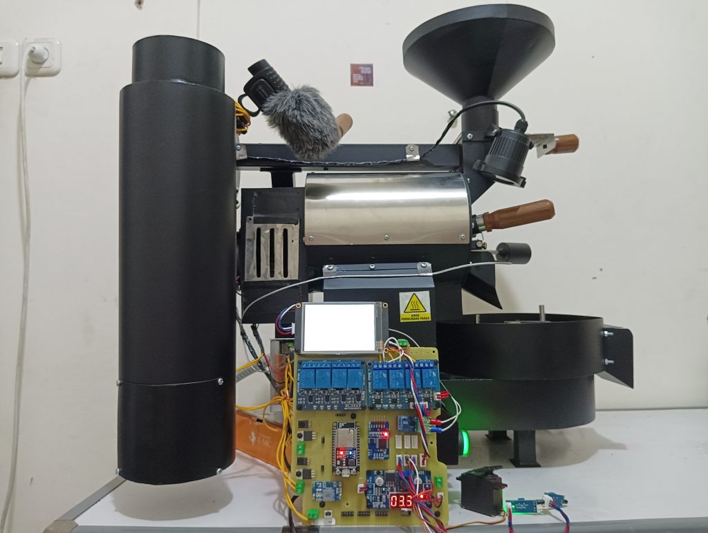
Smart Coffee Roaster integrated with E-Nose
Smart Coffee is a device we developed to automatically roast raw coffee beans into beans that are ready to grind. We built it with a touchscreen interface and a laptop dashboard that let users choose the type of coffee and adjust various roasting settings. What makes it even more exciting is that Smart Coffee uses a microphone and Artificial Intelligence to listen to the roasting process, helping it detect the roast level and identify the type of beans.
PKM DRAC 3D Scanner
3D Scanner Drone is one of our projects that expands the capabilities of drones in digital mapping and spatial modeling. We built this drone to create 3D models of real-world environments using photogrammetry or LIDAR systems. This project is especially useful for fields like architecture, cultural heritage preservation, mining, and urban planning. By integrating a flight control system, high precision GPS, and an onboard data processing module, our drone can produce accurate and efficient 3D visualizations.
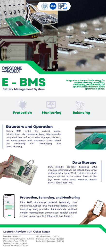
E-BMS
Our Battery Management System (BMS) consists of a mobile application, a microcontroller, and hardware components. The microcontroller collects data from temperature, voltage, and current sensors, then processes this information to monitor battery status and protect it from overcharging or overdischarging. Our BMS includes features such as protection, balancing, and monitoring. The sensors continuously track the battery’s condition, the balancing system optimizes cell capacity, and the mobile app makes it easy to monitor battery health through Bluetooth Low Energy (BLE) communication. We also integrated a balancing controller to maintain cell balance. Sensor data is stored on an SD card, and the system connects to the mobile app via Bluetooth as well as to an online server for real-time battery condition monitoring.
Rover drone
Rover Drone is one of our innovations, an unmanned aerial vehicle (UAV) that we designed to explore challenging terrains autonomously. We developed it using a multi terrain navigation approach, which allows it to smoothly transition between flying and ground movement. This makes it especially useful for exploring extreme environments, supporting search and rescue missions, and mapping remote areas.